![Japan region division _ Kanto _ prefectural office location _ gry, JPG, PNG and EPS Japan region division _ Kanto _ prefectural office location _ gry, , JPG, PNG and EPS](https://thumb.ac-illust.com/37/376b54c3d24fbe134e10ce54b96c840f_t.jpeg)
Japan region division _ Kanto _ prefectural office location _ gry
![Illustration set with prefecture letters, JPG, PNG and AI Illustration set with prefecture letters, , JPG, PNG and AI](https://thumb.ac-illust.com/41/4113e32ea1509ff3c01b35028e022d4e_t.jpeg)
Illustration set with prefecture letters
![Saitama City, Saitama Prefecture Prefectural Office Location North, JPG and AI Saitama City, Saitama Prefecture Prefectural Office Location North, , JPG and AI](https://thumb.ac-illust.com/ff/ff592ff08b16d4a17f52a0c15f43b6bc_t.jpeg)
Saitama City, Saitama Prefecture Prefectural Office Location North
![Kanto region, JPG, PNG and AI Kanto region, , JPG, PNG and AI](https://thumb.ac-illust.com/bf/bf69366caecc5e2452db570bc33dbda2_t.jpeg)
Kanto region
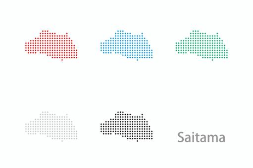
![Dot map_Saitama prefecture-Diamond 02, JPG and PNG Dot map_Saitama prefecture-Diamond 02, , JPG and PNG](https://thumb.ac-illust.com/86/86783cc0dcb467a148fa079af42becd7_t.jpeg)
Dot map_Saitama prefecture-Diamond 02
![Japan region division _ Kanto _ English prefecture name _ bk, JPG, PNG and EPS Japan region division _ Kanto _ English prefecture name _ bk, , JPG, PNG and EPS](https://thumb.ac-illust.com/07/072f51842bfbb0927a2dba8a06979707_t.jpeg)
Japan region division _ Kanto _ English prefecture name _ bk
![With all our heart, Kanto Prefecture logo set, JPG, PNG and AI With all our heart, Kanto Prefecture logo set, , JPG, PNG and AI](https://thumb.ac-illust.com/8e/8e27cf65a7794d1a6ba812317d3c27f9_t.jpeg)
With all our heart, Kanto Prefecture logo set
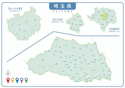
![Saitama City, Saitama Prefecture Prefectural Office Location Boundary, JPG and AI Saitama City, Saitama Prefecture Prefectural Office Location Boundary, , JPG and AI](https://thumb.ac-illust.com/c1/c14329e605238f03a10c94331754fda9_t.jpeg)
Saitama City, Saitama Prefecture Prefectural Office Location Boundary
![Kanto region silhouette set, JPG, PNG and EPS Kanto region silhouette set, , JPG, PNG and EPS](https://thumb.ac-illust.com/da/da7b3fdea98f614c0d3cdc7ddebbc537_t.jpeg)
Kanto region silhouette set
![Kanto region silhouette, JPG and PNG Kanto region silhouette, , JPG and PNG](https://thumb.ac-illust.com/d1/d19c80941ec6a2329a5395ce48f3277e_t.jpeg)
Kanto region silhouette
![Kanto Prefecture, JPG and PNG Kanto Prefecture, , JPG and PNG](https://thumb.ac-illust.com/a0/a0e801f80749ebfa98112f59053113e9_t.jpeg)
Kanto Prefecture
![Map of Saitama Prefecture drawn with city and town names, JPG, PNG and EPS Map of Saitama Prefecture drawn with city and town names, , JPG, PNG and EPS](https://thumb.ac-illust.com/89/8947b333091dec3df2a8f3706e67ebfb_t.jpeg)
Map of Saitama Prefecture drawn with city and town names
![関東(都道府県筆文字)フリー素材, JPG and PNG 関東(都道府県筆文字)フリー素材, , JPG and PNG](https://thumb.ac-illust.com/95/95e9fd4307bca23e8ff48121dcc3ee68_t.jpeg)
関東(都道府県筆文字)フリー素材
![Tobu 500 series train_2, JPG, PNG and AI Tobu 500 series train_2, , JPG, PNG and AI](https://thumb.ac-illust.com/ec/ecfab453e5ad382895baebc4c1257682_t.jpeg)
Tobu 500 series train_2
![Saitama Illustration Set-14 Species-wh, JPG and PNG Saitama Illustration Set-14 Species-wh, , JPG and PNG](https://thumb.ac-illust.com/4f/4f8b133e36a0ff380fa5562d1ca85e9d_t.jpeg)
Saitama Illustration Set-14 Species-wh
![Design map_Saitama-stitch, JPG, PNG and EPS Design map_Saitama-stitch, , JPG, PNG and EPS](https://thumb.ac-illust.com/0e/0e8be0ac620c712773140d8a53863e92_t.jpeg)
Design map_Saitama-stitch
![Design map_Saitama-rounded corners, JPG, PNG and EPS Design map_Saitama-rounded corners, , JPG, PNG and EPS](https://thumb.ac-illust.com/27/273006ddbf2eb29117b54376b4ce4803_t.jpeg)
Design map_Saitama-rounded corners
![Prefecture name seal icon set - Saitama, JPG, PNG and AI Prefecture name seal icon set - Saitama, , JPG, PNG and AI](https://thumb.ac-illust.com/28/284b134adcf972f61a2336f1b9156d82_t.jpeg)
Prefecture name seal icon set - Saitama
![Saitama various SET_ calligraphy handwriting, JPG, PNG and AI Saitama various SET_ calligraphy handwriting, , JPG, PNG and AI](https://thumb.ac-illust.com/09/094c26d132d3f2be6979b689e6f2344f_t.jpeg)
Saitama various SET_ calligraphy handwriting
![Saitama illustration set-14 species-gr, JPG and PNG Saitama illustration set-14 species-gr, , JPG and PNG](https://thumb.ac-illust.com/80/80903bf84bb2f0263853b21f3573e49b_t.jpeg)
Saitama illustration set-14 species-gr
![Saitama hand drawn set, JPG, PNG and AI Saitama hand drawn set, , JPG, PNG and AI](https://thumb.ac-illust.com/15/15d14a2ac4f4abbc12d8deb54e833a93_t.jpeg)
Saitama hand drawn set
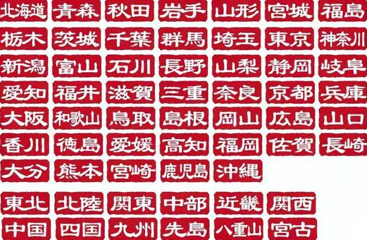
![Seal-style logo character set by prefecture, JPG, PNG and AI Seal-style logo character set by prefecture, , JPG, PNG and AI](https://thumb.ac-illust.com/a6/a652f713e96f4dedb2e2d5d9436486e1_t.jpeg)
Seal-style logo character set by prefecture
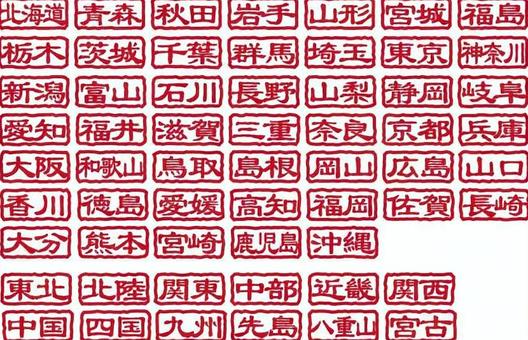
![Seal stamp style transparent icon by prefecture, JPG, PNG and AI Seal stamp style transparent icon by prefecture, , JPG, PNG and AI](https://thumb.ac-illust.com/12/120f2ad950d11e2cd2d7ab2c92f1de32_t.jpeg)
Seal stamp style transparent icon by prefecture
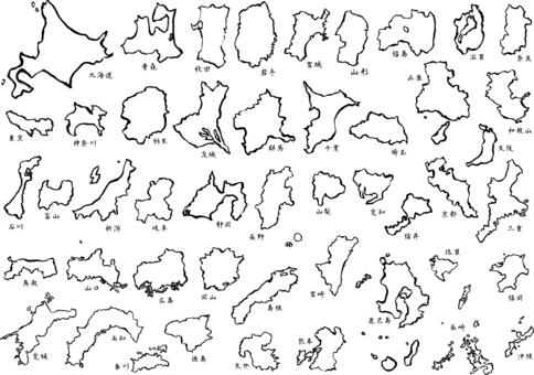
![11 map of japan - brush map a, JPG, PNG and AI 11 map of japan - brush map a, , JPG, PNG and AI](https://thumb.ac-illust.com/f6/f6f47a1e5852e2f8472b244113a68212_t.jpeg)
11 map of japan - brush map a
![Prefecture icon set/Kanto region, JPG, PNG and AI Prefecture icon set/Kanto region, , JPG, PNG and AI](https://thumb.ac-illust.com/47/47a040b65dfdd2657ab29d7e01cad7d3_t.jpeg)
Prefecture icon set/Kanto region
![Handwritten illustration set named after Saitama Prefecture, JPG and PNG Handwritten illustration set named after Saitama Prefecture, , JPG and PNG](https://thumb.ac-illust.com/33/3359bac68aefad951a3016a6154459f3_t.jpeg)
Handwritten illustration set named after Saitama Prefecture
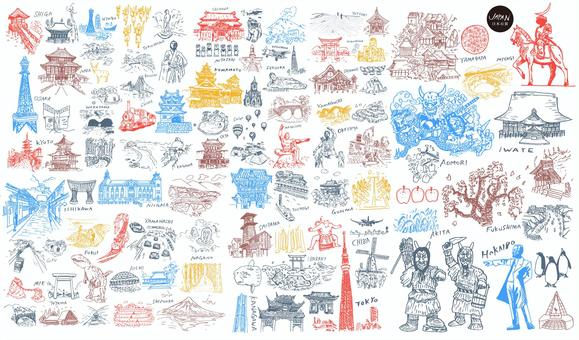
![Japan's famous places and culture, JPG, PNG and AI Japan's famous places and culture, , JPG, PNG and AI](https://thumb.ac-illust.com/6f/6f8b3b6594db39824b9014ed0ec9eb96_t.jpeg)
Japan's famous places and culture
![Saitama Prefecture Illustration Set-12 Types-gry, JPG, PNG and EPS Saitama Prefecture Illustration Set-12 Types-gry, , JPG, PNG and EPS](https://thumb.ac-illust.com/d7/d7801c0d39c4c4a4c4995b000bd28221_t.jpeg)
Saitama Prefecture Illustration Set-12 Types-gry
![Saitama Prefecture Illustration Set-12 Types-gr, JPG, PNG and EPS Saitama Prefecture Illustration Set-12 Types-gr, , JPG, PNG and EPS](https://thumb.ac-illust.com/30/30c44c4ddaddd60fa2b0caf810f54c13_t.jpeg)
Saitama Prefecture Illustration Set-12 Types-gr
![47 prefecture map, JPG, PNG and EPS 47 prefecture map, , JPG, PNG and EPS](https://thumb.ac-illust.com/d3/d381e534584f15670381fff036ea6971_t.jpeg)
47 prefecture map
![Seal stamp characters by region of origin/Kanto region, JPG, PNG and AI Seal stamp characters by region of origin/Kanto region, , JPG, PNG and AI](https://thumb.ac-illust.com/74/7449e8acfa41dd6bdab719b384e0a587_t.jpeg)
Seal stamp characters by region of origin/Kanto region
![Map of Tochigi Prefecture drawn with city and town names, JPG, PNG and EPS Map of Tochigi Prefecture drawn with city and town names, , JPG, PNG and EPS](https://thumb.ac-illust.com/52/52dfa20802d49949bab73bee967b9eda_t.jpeg)
Map of Tochigi Prefecture drawn with city and town names
![Prefectural calligraphy icons/Kanto, JPG, PNG and AI Prefectural calligraphy icons/Kanto, , JPG, PNG and AI](https://thumb.ac-illust.com/28/2822f4a724ba54e3293785dc1a0fe27d_t.jpeg)
Prefectural calligraphy icons/Kanto
![Map of Chiba Prefecture drawn with city and town names, JPG, PNG and EPS Map of Chiba Prefecture drawn with city and town names, , JPG, PNG and EPS](https://thumb.ac-illust.com/7d/7d3abd847bb6813739af4217a96c23a6_t.jpeg)
Map of Chiba Prefecture drawn with city and town names
![Map of Kanagawa Prefecture drawn with city and town names, JPG, PNG and EPS Map of Kanagawa Prefecture drawn with city and town names, , JPG, PNG and EPS](https://thumb.ac-illust.com/36/36de533ddf096e3f7384f2e8230cabfd_t.jpeg)
Map of Kanagawa Prefecture drawn with city and town names
![Municipal map _ Ibaraki prefecture _ deformation-01, JPG and PNG Municipal map _ Ibaraki prefecture _ deformation-01, , JPG and PNG](https://thumb.ac-illust.com/c8/c85d18b79dfdd98fb68ce90c9f6fc57a_t.jpeg)
Municipal map _ Ibaraki prefecture _ deformation-01
![Municipality map_Gunma prefecture_Deformation-03, JPG, PNG and EPS Municipality map_Gunma prefecture_Deformation-03, , JPG, PNG and EPS](https://thumb.ac-illust.com/a0/a0eebbdd40908bce4ccf3d0dccb6ba88_t.jpeg)
Municipality map_Gunma prefecture_Deformation-03
![Municipal map _ Ibaraki prefecture _ deformation-04, JPG, PNG and EPS Municipal map _ Ibaraki prefecture _ deformation-04, , JPG, PNG and EPS](https://thumb.ac-illust.com/76/765aea907e2edf3748ee154362ea995e_t.jpeg)
Municipal map _ Ibaraki prefecture _ deformation-04
![Municipal map _ Ibaraki prefecture _ deformation-05, JPG, PNG and EPS Municipal map _ Ibaraki prefecture _ deformation-05, , JPG, PNG and EPS](https://thumb.ac-illust.com/15/1522ef7280fd60e5f1c41c23f0b67cc6_t.jpeg)
Municipal map _ Ibaraki prefecture _ deformation-05
![Municipal map _ Ibaraki prefecture _ deformation-03, JPG, PNG and EPS Municipal map _ Ibaraki prefecture _ deformation-03, , JPG, PNG and EPS](https://thumb.ac-illust.com/5b/5bfd11d379ebca8fc5abc67ccfc5d7f7_t.jpeg)
Municipal map _ Ibaraki prefecture _ deformation-03
![Municipal map _ Ibaraki prefecture _ deformation-02, JPG, PNG and EPS Municipal map _ Ibaraki prefecture _ deformation-02, , JPG, PNG and EPS](https://thumb.ac-illust.com/8c/8cdea5e0ba0ed0a83defa2dddfa4b04a_t.jpeg)
Municipal map _ Ibaraki prefecture _ deformation-02
![Map of towns and villages_Gunma Prefecture_Deformation-02, JPG, PNG and EPS Map of towns and villages_Gunma Prefecture_Deformation-02, , JPG, PNG and EPS](https://thumb.ac-illust.com/5d/5d0d32bbd5bec9b0e546718dcaa216f0_t.jpeg)
Map of towns and villages_Gunma Prefecture_Deformation-02
![Municipality map_Gunma prefecture_Deformation-09, JPG, PNG and EPS Municipality map_Gunma prefecture_Deformation-09, , JPG, PNG and EPS](https://thumb.ac-illust.com/2c/2c032420d244a6c80eb51ecf7bb957a8_t.jpeg)
Municipality map_Gunma prefecture_Deformation-09
![Map of Tokyo drawn with city and town names, JPG, PNG and EPS Map of Tokyo drawn with city and town names, , JPG, PNG and EPS](https://thumb.ac-illust.com/81/814f6e115b3360c431eab2f0cbee883d_t.jpeg)
Map of Tokyo drawn with city and town names
![saitama monochrome, JPG and PNG saitama monochrome, , JPG and PNG](https://thumb.ac-illust.com/d0/d0cf17fd86425298997b2bfd356cba87_t.jpeg)
saitama monochrome
![Saitama, JPG, PNG and EPS Saitama, , JPG, PNG and EPS](https://thumb.ac-illust.com/30/30b833400408d4136967abd6a146f828_t.jpeg)
Saitama
![Anthropomorphized Saitama ken, JPG, PNG and EPS Anthropomorphized Saitama ken, , JPG, PNG and EPS](https://thumb.ac-illust.com/ed/ed7adbb33e5ff97dccaaabc7eefd614f_t.jpeg)
Anthropomorphized Saitama ken
![Modern map of Saitama prefecture with administrative divisions (silver-gray), JPG, PNG and AI Modern map of Saitama prefecture with administrative divisions (silver-gray), , JPG, PNG and AI](https://thumb.ac-illust.com/cd/cdd781f83c088fdac7711bfcf426c6b2_t.jpeg)
Modern map of Saitama prefecture with administrative divisions (silver-gray)
![Japan map ~ Regional division ~ Standard simple, JPG, PNG and AI Japan map ~ Regional division ~ Standard simple, , JPG, PNG and AI](https://thumb.ac-illust.com/7c/7c9080ba7506ab4901d498100b60a550_t.jpeg)
Japan map ~ Regional division ~ Standard simple
![Saitama prefecture map illustration (without lines), JPG, PNG and EPS Saitama prefecture map illustration (without lines), , JPG, PNG and EPS](https://thumb.ac-illust.com/14/14d818fbc22f5b9a0bb787415055b8c3_t.jpeg)
Saitama prefecture map illustration (without lines)
![Saitama prefecture map illustration (with lines), JPG, PNG and EPS Saitama prefecture map illustration (with lines), , JPG, PNG and EPS](https://thumb.ac-illust.com/ca/cabc8e425add9324138ca8ddec759ec6_t.jpeg)
Saitama prefecture map illustration (with lines)
![Illustration of a map of Saitama prefecture (with city and town names), JPG, PNG and EPS Illustration of a map of Saitama prefecture (with city and town names), , JPG, PNG and EPS](https://thumb.ac-illust.com/5b/5bc9a9df6b29ac1087f6f16a10e4c8f5_t.jpeg)
Illustration of a map of Saitama prefecture (with city and town names)
![A fluffy map of Saitama prefecture with administrative divisions, JPG, PNG and AI A fluffy map of Saitama prefecture with administrative divisions, , JPG, PNG and AI](https://thumb.ac-illust.com/92/922c82386b934ed8535abd257da6177f_t.jpeg)
A fluffy map of Saitama prefecture with administrative divisions
![Kanto Region Map, JPG, PNG and AI Kanto Region Map, , JPG, PNG and AI](https://thumb.ac-illust.com/bf/bf245e4789773dc424c7cbb9170b6c65_t.jpeg)
Kanto Region Map
![Saitama Prefecture City Map , JPG, PNG and AI Saitama Prefecture City Map , , JPG, PNG and AI](https://thumb.ac-illust.com/2d/2d25fc8d8fd9492a8a6cf944d253c762_t.jpeg)
Saitama Prefecture City Map
![Map of Saitama prefecture ☆ SAITAMA ☆ POP logo, JPG, PNG and AI Map of Saitama prefecture ☆ SAITAMA ☆ POP logo, , JPG, PNG and AI](https://thumb.ac-illust.com/8e/8e5fb33b915cdcb7c9357dfa73525f3c_t.jpeg)
Map of Saitama prefecture ☆ SAITAMA ☆ POP logo
![Map of Japan, JPG, PNG and AI Map of Japan, , JPG, PNG and AI](https://thumb.ac-illust.com/8f/8fb65ad1153106d243876d67e7bacd8f_t.jpeg)
Map of Japan
![Map of Japan _ Color, JPG, PNG and AI Map of Japan _ Color, , JPG, PNG and AI](https://thumb.ac-illust.com/e8/e87b2a442e367617663e262f2f1ff14e_t.jpeg)
Map of Japan _ Color
![Japan Map JAPAN MAP!, JPG and AI Japan Map JAPAN MAP!, , JPG and AI](https://thumb.ac-illust.com/c0/c0560fbf657e5ec4b17ea60a91b0a11b_t.jpeg)
Japan Map JAPAN MAP!
![A simple road map of the capital region, JPG A simple road map of the capital region, , JPG](https://thumb.ac-illust.com/00/00b40fe868933d2b32021df0f68e8783_t.jpeg)
A simple road map of the capital region
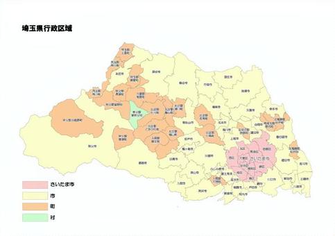
![Saitama prefecture municipality municipal administrative area, JPG, PNG and AI Saitama prefecture municipality municipal administrative area, , JPG, PNG and AI](https://thumb.ac-illust.com/62/62df9d6c99d41d35107c901cdcda27de_t.jpeg)
Saitama prefecture municipality municipal administrative area
![Map of Japan, JPG, PNG and AI Map of Japan, , JPG, PNG and AI](https://thumb.ac-illust.com/14/1453bc6b1d47ad2ff0d14617bb9eb2ff_t.jpeg)
Map of Japan
![Saitama, JPG and AI Saitama, , JPG and AI](https://thumb.ac-illust.com/72/7294bfdf5b64ad97cca44edbee1cac48_t.jpeg)
Saitama
![Kanto region, JPG, PNG and EPS Kanto region, , JPG, PNG and EPS](https://thumb.ac-illust.com/23/2365ad2eb05dfd0f820021903d7b57f3_t.jpeg)
Kanto region
![Map of Japan [7] by prefecture, JPG, PNG and AI Map of Japan [7] by prefecture, , JPG, PNG and AI](https://thumb.ac-illust.com/fb/fb41a2ca6a8201fdf19f24fde6624697_t.jpeg)
Map of Japan [7] by prefecture
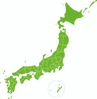
![Japan Map Prefecture, JPG, PNG and AI Japan Map Prefecture, , JPG, PNG and AI](https://thumb.ac-illust.com/ef/ef18a93ae2a1ca9669c77f45a85da9a1_t.jpeg)
Japan Map Prefecture
![Saitama Prefecture [Major cities included], JPG, PNG and AI Saitama Prefecture [Major cities included], , JPG, PNG and AI](https://thumb.ac-illust.com/e3/e3fdd2bbd2e9ac0e030c97cbf3b3812a_t.jpeg)
Saitama Prefecture [Major cities included]
![Map of Saitama Prefecture, JPG, PNG and AI Map of Saitama Prefecture, , JPG, PNG and AI](https://thumb.ac-illust.com/8f/8fc2de270dbca149c72d61126ef6dc7d_t.jpeg)
Map of Saitama Prefecture
![Simple Saitama prefecture shape illustration, JPG, PNG and AI Simple Saitama prefecture shape illustration, , JPG, PNG and AI](https://thumb.ac-illust.com/2d/2de4070ac71d977ada13f23e79c578df_t.jpeg)
Simple Saitama prefecture shape illustration
![Japan's hundred scenes, JPG, PNG and AI Japan's hundred scenes, , JPG, PNG and AI](https://thumb.ac-illust.com/b1/b12098d4c0167edf21ea5d0b94988960_t.jpeg)
Japan's hundred scenes
![Map of Chiba Prefecture Entering the name of the municipality, JPG, PNG and AI Map of Chiba Prefecture Entering the name of the municipality, , JPG, PNG and AI](https://thumb.ac-illust.com/54/5429219bb12b89db1528a51a12ce2498_t.jpeg)
Map of Chiba Prefecture Entering the name of the municipality
![Nationwide prefectures stamp seal red, JPG, PNG and AI Nationwide prefectures stamp seal red, , JPG, PNG and AI](https://thumb.ac-illust.com/48/488cc5a4b3133eaecfcf1fb95f3aaed7_t.jpeg)
Nationwide prefectures stamp seal red
![Kanto region (including prefectural capitals), JPG, PNG and AI Kanto region (including prefectural capitals), , JPG, PNG and AI](https://thumb.ac-illust.com/e3/e3820e4dd241a6fae4ed6d9430a31485_t.jpeg)
Kanto region (including prefectural capitals)
![Saitama Prefecture, JPG, PNG and AI Saitama Prefecture, , JPG, PNG and AI](https://thumb.ac-illust.com/77/77f4b910b96db7d53e1de0e950dfa0d9_t.jpeg)
Saitama Prefecture
![Japan map blank map, JPG and PNG Japan map blank map, , JPG and PNG](https://thumb.ac-illust.com/64/6441218401bdce94a2801604988d686a_t.jpeg)
Japan map blank map
![Japan map blank map, JPG and PNG Japan map blank map, , JPG and PNG](https://thumb.ac-illust.com/63/634f4ecafa4d8b894d20e8bef27284c3_t.jpeg)
Japan map blank map
![Japan Map, JPG and PNG Japan Map, , JPG and PNG](https://thumb.ac-illust.com/4a/4ac98da5f0f0a5a02c0931a7c6e87ff0_t.jpeg)
Japan Map
![Japan Map, JPG and PNG Japan Map, , JPG and PNG](https://thumb.ac-illust.com/1c/1c4cf649548f2f1f3ffdab3cf91bb2d3_t.jpeg)
Japan Map
![Saitama, JPG, PNG and AI Saitama, , JPG, PNG and AI](https://thumb.ac-illust.com/2c/2c09f88c4abe5dcf9ac58a17f0f9fc56_t.jpeg)
Saitama
![Illustration of Japan map by prefecture, JPG, PNG and AI Illustration of Japan map by prefecture, , JPG, PNG and AI](https://thumb.ac-illust.com/9c/9c2882aa2006c8c9b7e14f978ab96397_t.jpeg)
Illustration of Japan map by prefecture
![Blank map of Tokyo, JPG, PNG and AI Blank map of Tokyo, , JPG, PNG and AI](https://thumb.ac-illust.com/f7/f788d221bd1199f696823cf3257855c3_t.jpeg)
Blank map of Tokyo
![Blank map of Tokyo, JPG, PNG and AI Blank map of Tokyo, , JPG, PNG and AI](https://thumb.ac-illust.com/f1/f1c6075ceb8a65bdb8d825089bae6ea6_t.jpeg)
Blank map of Tokyo
![Man playing the shamisen, JPG, PNG and EPS Man playing the shamisen, , JPG, PNG and EPS](https://thumb.ac-illust.com/60/6066a4f9cdd4cf8c6a978500c884a02b_t.jpeg)
Man playing the shamisen
![Saitama Prefecture Kanto prefecture illustration Saitama, JPG, PNG and AI Saitama Prefecture Kanto prefecture illustration Saitama, , JPG, PNG and AI](https://thumb.ac-illust.com/0c/0c9afe11a172086a919548f2ecaef330_t.jpeg)
Saitama Prefecture Kanto prefecture illustration Saitama
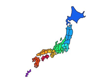
![Simple map of Japan with prefectural borders, JPG, PNG and EPS Simple map of Japan with prefectural borders, , JPG, PNG and EPS](https://thumb.ac-illust.com/dd/dd42f4bf9b5d706651f052c24bac3804_t.jpeg)
Simple map of Japan with prefectural borders
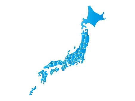
![Simple map of Japan with prefectural borders, JPG, PNG and EPS Simple map of Japan with prefectural borders, , JPG, PNG and EPS](https://thumb.ac-illust.com/cc/ccce78a6430e55cd1734361b22e84d90_t.jpeg)
Simple map of Japan with prefectural borders
![Simple map of Japan with prefectural borders, simple line drawing, JPG, PNG and EPS Simple map of Japan with prefectural borders, simple line drawing, , JPG, PNG and EPS](https://thumb.ac-illust.com/aa/aaab560db2647476c3398b8110ba94e6_t.jpeg)
Simple map of Japan with prefectural borders, simple line drawing
![Chiba, JPG, PNG and AI Chiba, , JPG, PNG and AI](https://thumb.ac-illust.com/70/70f5b562c494f06b2f444c9fdfd0a2d9_t.jpeg)
Chiba
![Map of Japan, JPG, PNG and AI Map of Japan, , JPG, PNG and AI](https://thumb.ac-illust.com/5a/5a53dab7a8d7cf64eac0f17351330eb6_t.jpeg)
Map of Japan
![埼玉県の地図, JPG, PNG and AI 埼玉県の地図, , JPG, PNG and AI](https://thumb.ac-illust.com/ab/abd51acfe4cc9891a5ae96ffd313d176_t.jpeg)
埼玉県の地図
![Map of Japan, JPG, PNG and AI Map of Japan, , JPG, PNG and AI](https://thumb.ac-illust.com/01/01c05f3b3d21708333e49c788cadd83c_t.jpeg)
Map of Japan
![Illustration of the shape of Chiba_outline, JPG, PNG and AI Illustration of the shape of Chiba_outline, , JPG, PNG and AI](https://thumb.ac-illust.com/52/52a35195ec8604e87db6cafa7c2e0511_t.jpeg)
Illustration of the shape of Chiba_outline
![埼玉県のイラスト , JPG and PNG 埼玉県のイラスト , , JPG and PNG](https://thumb.ac-illust.com/05/05090490a6d026d1a3c3925f1e72a978_t.jpeg)
埼玉県のイラスト
![Mi </s>, JPG, PNG and EPS Mi </s>, , JPG, PNG and EPS](https://thumb.ac-illust.com/7d/7d59ad9a236bef6def5ac1ad77c4f8ee_t.jpeg)
Mi </s>
![Simple Saitama prefecture, JPG, PNG and AI Simple Saitama prefecture, , JPG, PNG and AI](https://thumb.ac-illust.com/9b/9bd489948ae68ca2807de105a2bc5b34_t.jpeg)
Simple Saitama prefecture
![Japan map nationwide version [possible to divide prefecture parts], JPG, PNG and AI Japan map nationwide version [possible to divide prefecture parts], , JPG, PNG and AI](https://thumb.ac-illust.com/5f/5fd1218bd0d011030c9284a134b7469f_t.jpeg)
Japan map nationwide version [possible to divide prefecture parts]
![Sendai Tanabata 1, JPG, PNG and AI Sendai Tanabata 1, , JPG, PNG and AI](https://thumb.ac-illust.com/9a/9a9c85dee29b197af748813ad6b97aa1_t.jpeg)
Sendai Tanabata 1
![Japan map prefecture rose, JPG and AI Japan map prefecture rose, , JPG and AI](https://thumb.ac-illust.com/24/2492c3d502a569c7bd6b496a2268d130_t.jpeg)
Japan map prefecture rose
![Road map including Gunma prefecture and surrounding areas , JPG Road map including Gunma prefecture and surrounding areas , , JPG](https://thumb.ac-illust.com/be/be876e541b78da1afd433a40feeb169e_t.jpeg)
Road map including Gunma prefecture and surrounding areas
![さいたま市地図, JPG and PNG さいたま市地図, , JPG and PNG](https://thumb.ac-illust.com/c4/c4f58fd604aed4ad8ff2ec352c0594a3_t.jpeg)
さいたま市地図
809 Бесплатный векторный клипарт о .
Нужна векторной графики? Найдите лучшие изображения из категории .
Все векторные клипарты бесплатны даже для коммерческих проектов. Никакой атрибуции не требуется.